| Status: | Active, open to new members |
| Organiser: |
Bob Ruffles
|
| Group email: | Science Open group |
| When: | Monthly on Monday afternoons 2:00pm-4:00pm 2nd Monday, October to May |
| Venue: | Otford Village Memorial Hall |
| Cost: | £3.00 |

Open to all u3a members. Illustrated talks by visiting speakers on a wide range of science & technology topics. We also arrange visits to places of interest and an annual seminar.
We ask that attendees turn up in good time for a prompt 14:00 start as latecomers do disrupt proceedings and it is distracting for the speaker. Please note that due to increased hire charges of the OVMH, we have increased the door charge to £3.00.
Our next season of Science Open Meetings start on 12th October with a talk by Mike Thevethick on ‘Stomach Upsets’. We have a range of talks planned and we look forward to your attendance; more details will be given closer to the date. If you would like to help our team with organisation these meetings, please contact Bob Ruffles via the link above.
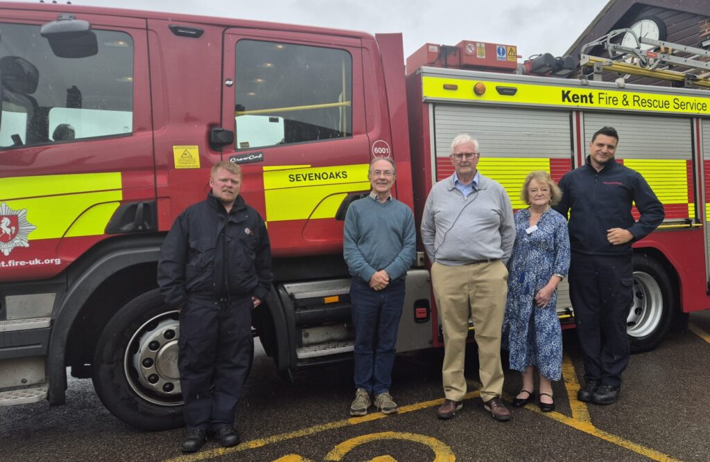
Our May talk was given by Lawrence Pater and Andrew Bridger-Smart of the Kent Fire Investigation Service. They presented a talk, including video clips of fires they had investigated in the Kent area, on the cause of fires in domestic environments and measures to reduce the risks. In addition, the Sevenoaks Fire Team, who were on call, attended with their fire engine.
The Sevenoaks team wanted to advertise the service they offer to homeowners and offered to undertake home inspections to check fire detectors, offer advice on fire risks in the home, and, where necessary, supply additional detectors free of charge.. Several of our members signed up for this service.
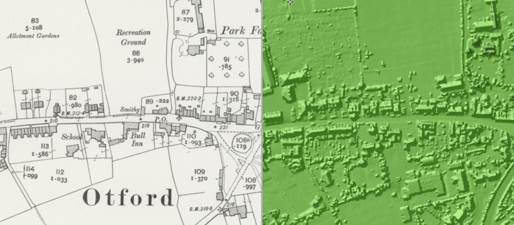
Our March talk was “Beyond the Compass: Mapping in the Digital Age” by Paul Frost which provided an overview of digital mapping applications, Ordnance Survey mapping and how satellite and aerial images can be used in mapping. Paul’s recommendation for an easy, enjoyable read about maps and mapmaking is How to Lie with Maps by Mark Monmonier, 3rd ed., 2018 and recommendations for online resources, all of which are freely available, are:-
- OpenStreetMaps:- An open source mapping tool similar to Google, Apple & Bing maps but which is maintained by a volunteer community which you can be part of. Maps are free to use and share under an open license.
- Earth@nullschool.net:- A beautiful near real-time visualisation of global weather conditions
- The National Library of Scotland mapping website, THE place to go to for historic maps of anywhere in the UK, including digitised versions of historic OS maps which can be overlayed with satellite and Lidar (Airborne Light Detection and Ranging) as per the map of Otford below.
Last updated 12 May 2026